|
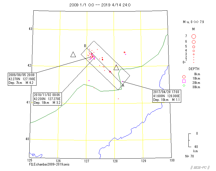
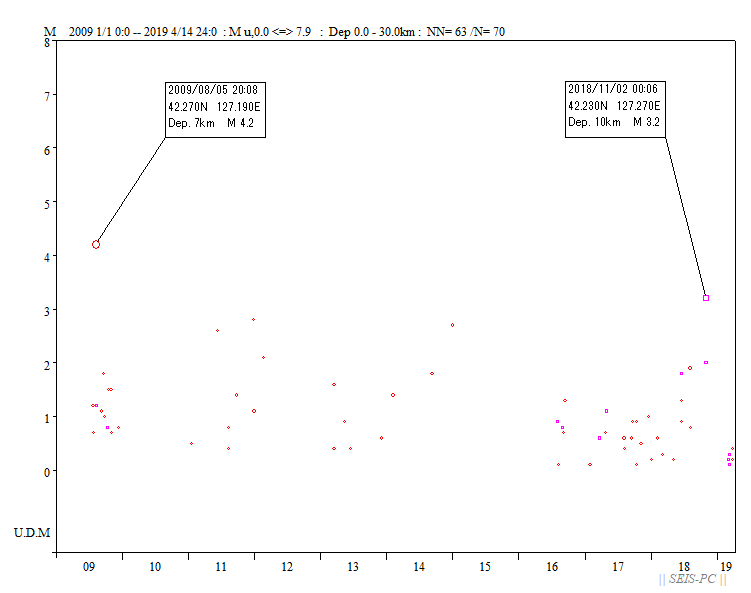
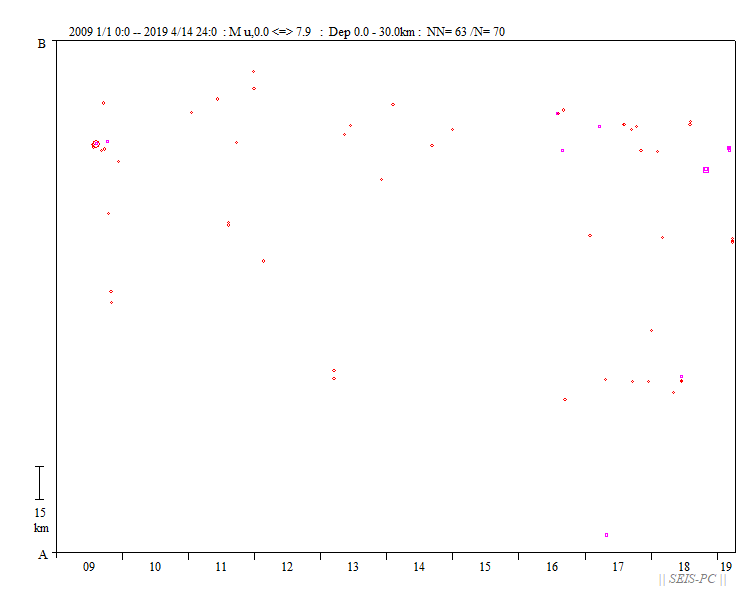
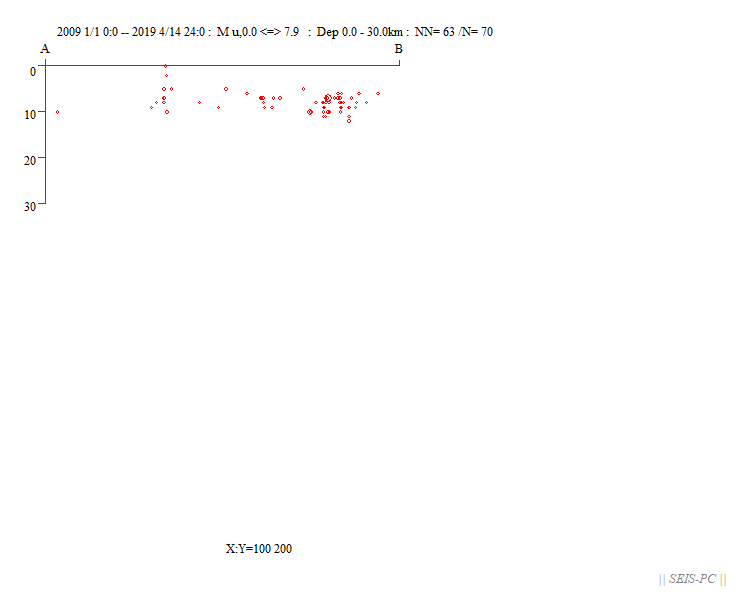
Seismicity near Baekdu-san(Changbaishanj  Fig.1 : Epicenter distribution from 2009 to 2019 Apr, 14 (Beijing time) by Unified catalog of Chinese seismic network. Latitude 41-43 N degree, Longitude 127-129 E dwgree. Depth 0km-30km. Triangles show Baekdu-san(right) and Mt. Longgang(Left). The green line shows the nation border. But I am sorry that the border data was not accurate, so Baekdu-san is located in China in this figure. It should be located on the border.  Fig.2 ; Magnitude-time figure in the cutout area in the fig.1.  Fig.3 : Time-space distribution in the cutout area in the fig.1. The lower side is Baekdu-san.  Fig.4 : Cross-section in the cutout area in the fig.1, The left side is Baekdu-san side. RETUEN |